The
Trail
To begin
the epic journey to Lone Pine Lake, you need to start your hike
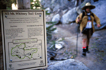
at the west end of the Lone Pine campground. There you'll see
a signed trailhead for the Whitney Portal National Recreation
Trail. Start here.
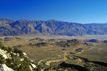
In the beginning you face a long slog through the
high-desert terrain with no shade so be sure to get an early start.
After a mile or so, the trail will begin a series of switchbacks
as you climb out of the sage into the Pinyon and Juniper zone.
You'll be treated to excellent views of awesome Lone Pine peak.
Soon the climbing will end (temporarily!) as the trail starts
to head west and you'll see and hear the power and the fury of
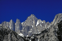
Lone Pine creek thundering down the narrow canyon. Mounts' Whitney,
Irvine, Russell and Muir (all above 14,000 ft.) are laid out beautifully
before your eyes as the trail starts to descend towards the raging
creek.
|
Once
the descent is over, be prepared for some tough hiking as the
trail begins to switchback up the south bank of Lone Pine creek.
The shade of beautiful Red Firs' and the sound of rushing water
will add some measure of comfort during this grueling stretch.
Once you start to make eye contact with the cabins, the first
leg of your hike will have been accomplished as you are very
close to the Whitney Portal store and campground.
The
trail will soon end as a bridge crosses over the creek and the
pavement begins. Welcome to Whitney Portal! The small store
here, is the perfect place to have lunch and relax before you
begin the 3 mile, 1,740 foot climb to Lone Pine Lake.
Walk just east of the store to pick up the Mount
Whitney trail. You'll begin a series of well-graded switchbacks
below massive granite walls. A couple of easy stream crossings
await you. Keep chugging as the trail continues to climb into
the Lodgepole zone.
The last bit of trail before you reach the lake is usually covered
in snow in May, but is easily followed as backpackers on the
way to Mount Whitney pound out a path to Lone Pine lake, a small
spur trail that branches off the main Mount Whitney trail to
your left.
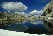
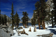
You'll
cross the creek and follow the snow tracks in a southeasterly
direction and shortly you will finally reach your destination,
spectacular Lone Pine Lake.
Return the way you came.
|